Export Tracks Command
The Export Tracks command allows you to share the tracks in the Track List with users of other GPS and mapping software.
To export all of the tracks in the file, do the following:
- View the Track List
- Then, do one of the following:
- On the , click .
- Press Ctrl+E.
To export only the selected tracks, do the following:
- Select one or more tracks.
- Right-click on the selected tracks and click .
The Export Tracks dialog will appear.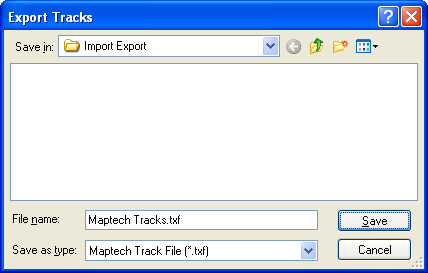
Select the type of file to export in the Save as Type list.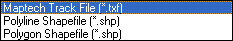
Select the type of file you want to export:
Maptech Track File (.txf)
Maptech's Terrain Navigator stores tracks in .txf files. See also Exporting Maptech Waypoints and Exporting Maptech Routes.
Polyline Shapefile (.shp)
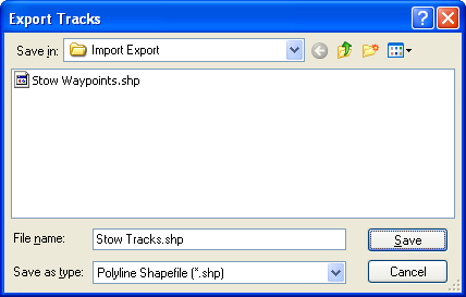
ExpertGPS will export the tracks to a polyline (linear) shapefile. The coordinate format in ExpertGPS is used to project the data. If the coordinate format is UTM, all data will be projected to the UTM zone containing the Active Point. ExpertGPS creates a database file (.dbf) containing track attributes.
Polyline Shapefile Attributes:
- Label
- Notes (Description)
- Type
Polygon Shapefile (.shp)
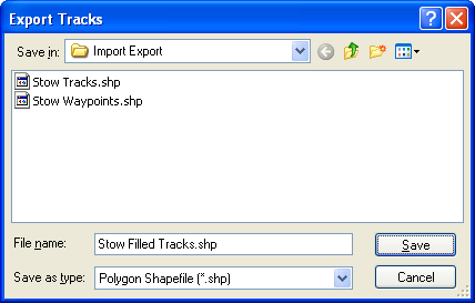
ExpertGPS will export the tracks to a polygon (filled) shapefile. The coordinate format in ExpertGPS is used to project the data. If the coordinate format is UTM, all data will be projected to the UTM zone containing the Active Point. ExpertGPS creates a database file (.dbf) containing track attributes.
Polygon Shapefile Attributes:
- Label
- Notes (Description)
- Type
© 1998-2026 TopoGrafix – 24 Kirkland Dr, Stow, MA – Email: support@expertgps.com