Close Command
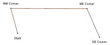
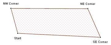
The Close command turns a linear route, track, or shape into a closed object. If you are surveying a property or marking the perimeter of a field, you can use the Close command to automatically connect the final point in your survey back to the point at which you started.
To close a route, track or shape, do the following:
- View a map, or a Route, Track or Shape List.
- Select one or more routes, tracks or shapes.
- Then, do one of the following:
- On the , click .
- Right-click on the selected items, and click .
Tip
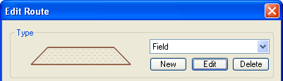
- If you edit a route, track, or shape, and select a Type that uses a Fill pattern, ExpertGPS will automatically close the item.
© 1998-2026 TopoGrafix – 24 Kirkland Dr, Stow, MA – Email: support@expertgps.com