Importing DXF and AutoCAD Files into ExpertGPS Pro

ExpertGPS Pro can import file geodatabases (.gdb) from ESRI ArcGIS and other GIS programs.
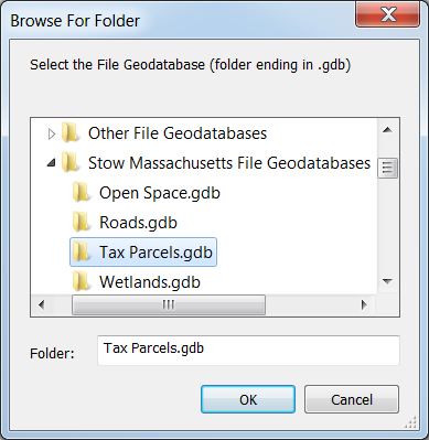
To import your file geodatabase, click Import File Geodatabase on the Convert menu, and select a .gdb folder in the Import File Geodatabase dialog.

Import File Geodatabase dialog

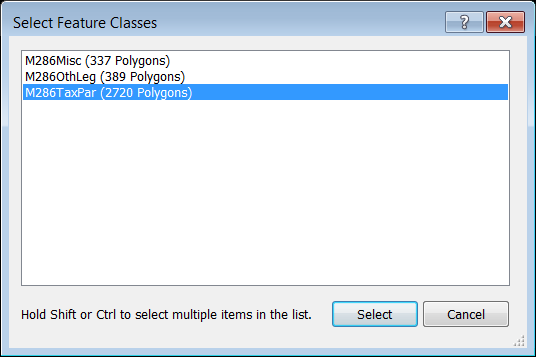
In the Select Feature Classes dialog, select one or more feature classes to import.

Select Feature Classes dialog

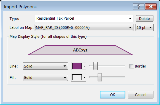
For each feature class you select to import, a dialog will appear, allowing you to specify how each class of point, polyline, and polygon data in your file geodatabase is displayed in ExpertGPS.

Import Polygons dialog

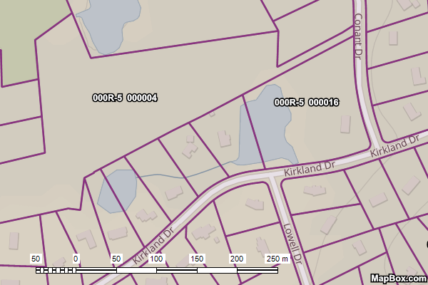
Your file geodatabase data will be imported and can now be viewed and edited over the street maps and aerial photos in ExpertGPS.

Tax Parcel Map, Imported from File Geodatabase, in ExpertGPS Pro
ExpertGPS is mapping and file conversion software for your Garmin GPS
ExpertGPS is mapping and file conversion software for your Magellan GPS
ExpertGPS is mapping and file conversion software for your Lowrance GPS
ExpertGPS works with hundreds of GPS receivers, including all Garmin Drive, nüvi, eTrex, Colorado, Dakota, echoMAP, GPSMAP, Edge, Forerunner, Montana, Oregon, and Rino models, Magellan eXplorist GPS receivers, and Lowrance HDS, Elite, and HOOK GPS chartplotters and fishfinders. Download ExpertGPS
Find your GPS on the ExpertGPS compatibility list.

© 1998-2024 TopoGrafix – 24 Kirkland Dr, Stow, MA – Email: support@expertgps.com