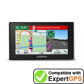
You're About to Unleash the Full Potential of Your Garmin DriveAssist 51 LMTHD!
Don't Miss These Easy Tips to Supercharge Your GPS. Download ExpertGPS!

Introducing ExpertGPS
ExpertGPS is GPS map software for your Windows computer, tablet, or laptop. ExpertGPS makes it easy to transfer waypoints, routes, and tracks, as well as GPS, GIS, and CAD data, to and from your Garmin DriveAssist 51 LMTHD.
ExpertGPS gives you access to every topo map in the USA, as well as high-resolution aerial photos, so you can zoom in on any trail or job site. ExpertGPS even works with your own scanned maps, and data from over 100 different mapping, GIS, and CAD programs.
ExpertGPS Home is an affordable outdoor trip planner at only $39/yr. ExpertGPS Pro contains all of the professional mapping features of high-end CAD and GIS packages, but without the steep learning curve and at a fraction of the price (now only $99/yr).
Thousands of businesses and GPS users depend on ExpertGPS mapping software to upload and download Garmin DriveAssist 51 LMTHD waypoints, routes, and tracks, make maps of their GPS data over seamless USGS topo maps and aerial photos, and convert and transfer Garmin DriveAssist 51 LMTHD data to and from Excel, Google Earth, ArcGIS, and AutoCAD. We've collected dozens of tips and tricks designed to save you time and money when mapping with your Garmin DriveAssist 51 LMTHD.
Browse Garmin DriveAssist 51 LMTHD tips by category:
Garmin Data Upload and Download, Map Making, Adding Waypoints and POIs, Coordinate Conversion, Google Earth and KML, ArcGIS and Shapefiles, AutoCAD DXF, Backing up your Garmin data, Downloading updates for your Garmin DriveAssist 51 LMTHD
Download a fully-featured trial of ExpertGPS, or buy your copy today. We're so confident ExpertGPS will save you time (as a GPS data downloader, coordinate converter, map viewer and editor, and GIS, CAD, and GPS data converter) that we make this guarantee: if ExpertGPS doesn't pay for itself in 14 days, we'll refund your money - and you can keep the software!
Get Started. Download Our Free ExpertGPS Trial Right Now!
New features were added to ExpertGPS on February 6, 2026
ExpertGPS runs on Windows 11 and Windows 10.
Uploading and Downloading Garmin DriveAssist 51 LMTHD Data
Download your Garmin DriveAssist 51 LMTHD waypoints to your computer
ExpertGPS can transfer Garmin DriveAssist 51 LMTHD waypoints through your computer's USB port. It only takes a second or two to download all of the data from your Garmin using ExpertGPS.
Upload new waypoints to your Garmin GPS
Transfer data back to your Garmin DriveAssist 51 LMTHD with a single click. Upload waypoints to your GPS and print a matching map out to take with you into the field. ExpertGPS even lets you upload Excel, Google Earth, CAD, and GIS data to your Garmin DriveAssist 51 LMTHD!
Maximize your GPS Memory
Your Garmin DriveAssist 51 LMTHD has limited storage space for waypoints. Once you reach that limit, your GPS can't hold any more data. Smart ExpertGPS users have figured out how to eke out every last bit of memory space on their Garmin GPS receivers. Before each outdoor adventure or visit to a project site, they use ExpertGPS to back up the contents of their GPS, and then clear the GPS data memory. They can then download as much data as possible onto their GPS (leaving some room for GPS data collection out in the field). When they get back, they use ExpertGPS to upload all of their Garmin waypoints onto their computer and save it. Once they've backed up the new data from their GPS, they can clear the memory again, keeping their GPS ready for their next trip.
Backup your Garmin DriveAssist 51 LMTHD waypoints
Backup your DriveAssist 51 LMTHD waypoints by using ExpertGPS to transfer them to your laptop or desktop computer. Now you've got a safe back-up of all of the important data on your DriveAssist 51 LMTHD, and use ExpertGPS to find and create new waypoints to download to your Garmin GPS. Before you update your Garmin DriveAssist 51 LMTHD firmware or install a custom basemap, Garmin recommends that you backup all of your GPS data. ExpertGPS gives you the peace-of-mind that your Garmin DriveAssist 51 LMTHD data is always safe.
Making Maps from your Garmin DriveAssist 51 LMTHD Data
Real 1:24000 USGS Topo Maps
View your Garmin DriveAssist 51 LMTHD waypoints over USGS topo maps and aerial photos. These are actual 1:24000 scale topographic maps from the US Geological Survey, giving you much more terrain detail than the maps that came with your Garmin.
Toggle between Topo, Aerial, and Color Orthophotos
Instantly switch between topo maps, aerial photos, and color urban imagery using the T, A, and U keys in ExpertGPS. This ability to toggle back-and-forth between several views of your GPS data is unique to ExpertGPS, and is one of its most popular features.
Give your maps a professional look
ExpertGPS comes preloaded with all the line patterns and cartographic styles you need to draw highways, railroad tracks, transmission lines, streams, and more. And the waypoint and track style editors let you create your own map symbols, change track colors, and customize exactly how your GPS and map data is drawn.
Boost your Garmin GPS data entry speed 500%!
Why waste time entering new waypoints on the tiny screen of your Garmin DriveAssist 51 LMTHD? ExpertGPS can do it 5x faster! Use the New Waypoint dialog in ExpertGPS to create new waypoints and POI listings for your Garmin GPS. As you type, ExpertGPS automatically suggests the best possible name for this waypoint on your GPS.
Garmin DriveAssist 51 LMTHD Waypoints and POIs

Maximize your Garmin waypoints
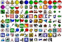
ExpertGPS lets you get the most out of the waypoints on your Garmin DriveAssist 51 LMTHD by making it easy to assign the best symbol and to give each waypoint a long, meaningful name (using a real keyboard, not the little controls on your GPS). Think about it:
Your Garmin DriveAssist 51 LMTHD can hold 1000 waypoints. Waypoints on the Garmin DriveAssist 51 LMTHD can contain up to 60 characters. Waypoint comments (notes) can contain up to 255 characters. How long would it take you to enter all of those waypoints by hand into your GPS? ExpertGPS will save you hours on this one task alone!
Add Photos and Notes to your waypoints
ExpertGPS lets you link a photo to any waypoint or POI and includes a built-in photo viewer. And you can add your own detailed description to any waypoint - store as much information as you need.
Prevent Data Entry Errors with ExpertGPS
GPS coordinates are easy to mis-type. Using the Waypoint Tool in ExpertGPS to create new waypoints reduces the chances of making a mistake when manually entering coordinates on your GPS. ExpertGPS takes care of all of the coordinate conversion and datum shifts when communicating with your Garmin DriveAssist 51 LMTHD, further reducing errors.
Garmin DriveAssist 51 LMTHD Coordinate Conversion
Convert between any coordinate format or datum
Need to convert NAD27 lat/lon to WGS84 UTM? ExpertGPS does it automatically. Enter coordinates in any format, in any datum. To convert Garmin DriveAssist 51 LMTHD coordinates to any other format, just select that format in ExpertGPS. All of your data is automatically reprojected to the new format and datum.
Convert to and from US State Plane Coordinates
ExpertGPS Pro lets you work with data in any US State Plane Coordinate System (SPCS). Even though your Garmin DriveAssist 51 LMTHD doesn't natively support SPCS, you can use ExpertGPS Pro to convert data back and forth between state plane coordinates, lat/lon, and UTM.
Convert any address to latitude and longitude for your Garmin DriveAssist 51 LMTHD
ExpertGPS converts addresses to GPS coordinates with its built-in address geocoder. Enter any address in the US (or in several dozen other countries) and ExpertGPS will bring up a map of that location and create a GPS waypoint you can send to your Garmin DriveAssist 51 LMTHD.
Locate property using PLSS (Township, Range, Section) coordinates
The Go to TRS command in ExpertGPS Pro will take you directly to any township and range in 17 western US states, allowing you to locate land in the US Public Land Survey System quickly. As you move over the map, the current township, range, and section is displayed. ExpertGPS Pro can even overlay a PLSS grid from BLM or your state GIS department.
Viewing Garmin DriveAssist 51 LMTHD Data in Google Earth
View your Garmin DriveAssist 51 LMTHD data in Google Earth
With ExpertGPS, you'll be able to view all of your driving trips over the aerial photos in Google Earth, showing exactly where you went. This feature is so popular in ExpertGPS, we've added a hot key (F7) that will automatically launch Google Earth and zoom in on your driving waypoints and tracklogs. And, we've also added the ability to download KML files back to your Garmin DriveAssist 51 LMTHD
Layering Garmin DriveAssist 51 LMTHD Data with GIS Data
Convert Garmin DriveAssist 51 LMTHD waypoints and tracks to ArcGIS SHP format
ExpertGPS makes it easy to update your GIS database with GPS data recorded in the field. Simply mark waypoints or record a tracklog on your Garmin DriveAssist 51 LMTHD, and then use ExpertGPS to upload your GPS data and export it as a shapefile. And you can Send GIS layers to your Garmin DriveAssist 51 LMTHD as well.
Using Garmin DriveAssist 51 LMTHD Data in CAD
Convert Garmin DriveAssist 51 LMTHD waypoints and tracks to ACAD's DXF drawing format
ExpertGPS allows you to convert your DriveAssist 51 LMTHD tracklogs and waypoints to AutoCAD's DXF format in two easy steps. Send AutoCAD DXF to your Garmin DriveAssist 51 LMTHD
Download a fully-featured trial of ExpertGPS, or buy your copy today. We're so confident ExpertGPS will save you time (as a GPS data downloader, coordinate converter, map viewer and editor, and GIS, CAD, and GPS data converter) that we make this guarantee: if ExpertGPS doesn't pay for itself in 14 days, we'll refund your money - and you can keep the software!
Get Started. Download Our Free ExpertGPS Trial Right Now!
New features were added to ExpertGPS on February 6, 2026
ExpertGPS runs on Windows 11 and Windows 10.
© 1998-2026 TopoGrafix – 24 Kirkland Dr, Stow, MA – 978-760-4039 – Email: support@expertgps.com
