Import, Convert, and Reproject Hawaii State Plane Coordinates
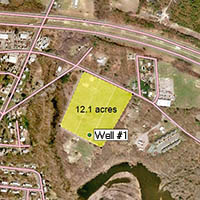
ExpertGPS Pro can convert between lat/long, UTM, and any of these state plane coordinate systems used in Hawaii. Need to send Hawaii state plane coordinates to your GPS? ExpertGPS will transfer Hawaii eastings and northings to any Garmin, Magellan, Lowrance, or Eagle GPS receiver. You can import, convert, and reproject GIS shapefiles from ArcMap, DXF CAD files from IntelliCAD and AutoCAD, or bring in X,Y data from any spreadsheet or CSV file. ExpertGPS maps all of your Hawaii state plane points and polylines over Hawaii topo maps, aerial photos, and your own scanned maps or site plans. Click on any of the links below to get step-by-step help in how to convert Hawaii state plane coordinates to lat/lon, UTM, or any other coordinate format, datum, or file format using ExpertGPS Pro.
How to Convert between Hawaii State Plane Coordinates, UTM, and Lat/Long
Click on one of the links below for step-by-step tutorials on converting between Hawaii northings and eastings and lat/long or UTM coordinates.How to convert Hawaii 1 coordinates in NAD27 datum to and from UTM or lat-lon
How to convert Hawaii 1 coordinates in NAD83 datum to and from UTM or lat-lon
Hawaii 1 FIPS 5101 covers these counties: Hawaii
How to convert Hawaii 2 coordinates in NAD27 datum to and from UTM or lat-lon
How to convert Hawaii 2 coordinates in NAD83 datum to and from UTM or lat-lon
Hawaii 2 FIPS 5102 covers these counties: Maui, Kalawao
How to convert Hawaii 3 coordinates in NAD27 datum to and from UTM or lat-lon
How to convert Hawaii 3 coordinates in NAD83 datum to and from UTM or lat-lon
Hawaii 3 FIPS 5103 covers these counties: Honolulu
How to convert Hawaii 4 coordinates in NAD27 datum to and from UTM or lat-lon
How to convert Hawaii 4 coordinates in NAD83 datum to and from UTM or lat-lon
Hawaii 4 FIPS 5104 covers these counties: Kauai
How to convert Hawaii 5 coordinates in NAD27 datum to and from UTM or lat-lon
How to convert Hawaii 5 coordinates in NAD83 datum to and from UTM or lat-lon
Hawaii 5 FIPS 5105 covers these counties: Kauai (Niihau Island)
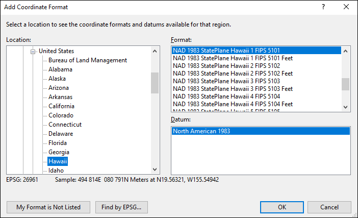
Adding Hawaii State Plane Coordinates to ExpertGPS Pro
ExpertGPS Pro can convert between any of the Hawaii coordinate formats shown in the Add Coordinate Format dialog below. For complete details and step-by-step instructions on solving the most popular data format and Hawaii coordinate conversion problems, click on one of the Hawaii State Plane links above.
© 1998-2026 TopoGrafix – 24 Kirkland Dr, Stow, MA – Email: support@expertgps.com