Scanned Map Library Dialog

Scanned Map Library dialog

Manage and add to your collection of scanned maps and digital charts using the Scanned Map Library dialog.
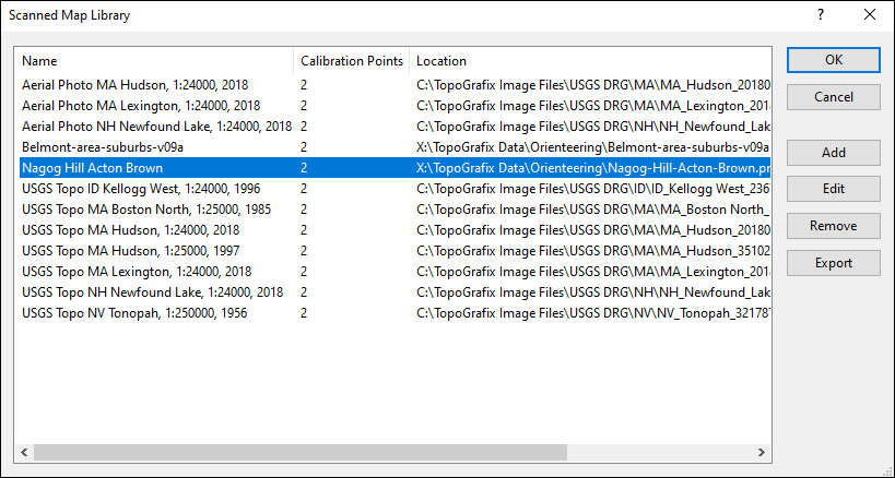
Scanned Map List
All of your scanned maps and digital charts are listed on the left side of the dialog. The name of the map, the number of calibration points and the map image's location are displayed. To use the Edit, Remove, or Export commands, select one or more scanned maps from the list.
Add
Click the Add button to add a new scanned map to the list.
Edit
Click the Edit button to rename the map or change the projection using the Edit Scanned Map dialog.
Remove
Click the Remove button to remove the map from the Scanned Map Library. The map image file is not deleted from your computer.
Export
Click the Export button to save the calibrated scanned map in a format that can be used by another mapping program.


ExpertGPS is GPS mapping software designed to work seamlessly with your Garmin, Magellan, Eagle, or Lowrance GPS receiver. ExpertGPS makes it easy to view waypoints and GPS tracklogs over USGS topo maps, aerial photos, and color orthophotos. ExpertGPS Pro can send GPS data to and from ArcView GIS and AutoCAD DXF and dozens of other standard file formats.


Return to Getting Started with ExpertGPS Map Software

Visit the ExpertGPS Homepage

Find your GPS on the Mapping Software for GPS compatibility page

Download a free trial of ExpertGPS map software (30 day demo, fully-featured)


Purchase ExpertGPS map software with a credit card, PayPal, or purchase order

$49.95


Download a free trial of ExpertGPS map software (30 day demo, fully-featured)

GPS Map Software
for Windows Vista/XP


New features added
December 2, 2008


GPS Support

ExpertGPS works with:

  • ExpertGPS is Garmin GPS Map Software
  • ExpertGPS is Magellan GPS Map Software
  • ExpertGPS is Lowrance GPS Map Software
  • ExpertGPS is Eagle GPS Map Software

Find your GPS model:


Copyright 1998-2008 TopoGrafix – 24 Kirkland Dr, Stow, MA – Email: Fax Orders: (815) 346-5239