Geocaching with ExpertGPS: Better Maps mean Faster Finds!
The Secret to Successful Geocaching
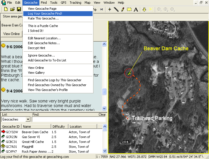
ExpertGPS has long been the secret tool used by so many successful geocachers. With seamless USGS topographical maps and aerial photo coverage of the entire United States, ExpertGPS makes it easy to plan out a day of geocaching, locate parking, and get a bird's eye view of the terrain before you go.
ExpertGPS and Geocaching have a long history together, dating back to origins of the game. Dan Foster, author of ExpertGPS, and Jeremy Irish, founder of geocaching.com, worked together to create the .loc file format used to transfer geocaches to EasyGPS and ExpertGPS so that geocachers could send caches to their GPS receivers without having to type in coordinates by hand. A few months later, Dan, Jeremy, and some other authors got together to create GPX, the GPS Exchange Format, now used by every popular GPS and mapping program. ExpertGPS uses GPX internally, and continues to be one of the leading programs for viewing and creating GPX data.
Special Features in ExpertGPS Just for Geocachers!
With so many geocachers using ExpertGPS, Dan added special features just for geocaching. A built-in geocaching Web browser, support for Travel Bugs, automatic cache logging, and GPS and smartphone data transfer are just some of the new geocaching features in ExpertGPS Home and ExpertGPS Pro.
If you are an occasional geocacher, an outdoor-enthusiast who would like to try geocaching someday, or a full-blown Geocaching Addict, you'll appreciate all of the extra geocaching features in ExpertGPS geocaching software.
New features were added to ExpertGPS on August 29, 2025
ExpertGPS runs on Windows 11 and Windows 10.
© 1998-2025 TopoGrafix – 24 Kirkland Dr, Stow, MA – Email: support@expertgps.com